Ewa ad Amorem
Lex Francorum Chamavorum
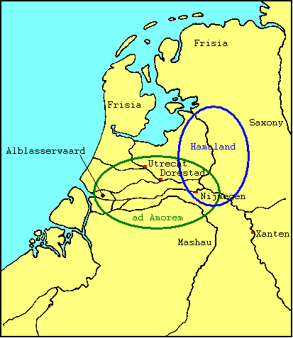
A map of the Low Lands in Carolingian times, with the names of locations that are relevant to the Ewa ad Amorem. The borders lines of the Amor-area according to Niermeyer (1955) (green) and of Hamaland (blue) are only indicative. |
|
Home
e-mail: kees.nieuwenhuijsen@tip.nl | English |
Introduction
Text Map | Nederlands |
Inleiding
Tekst Kaart |